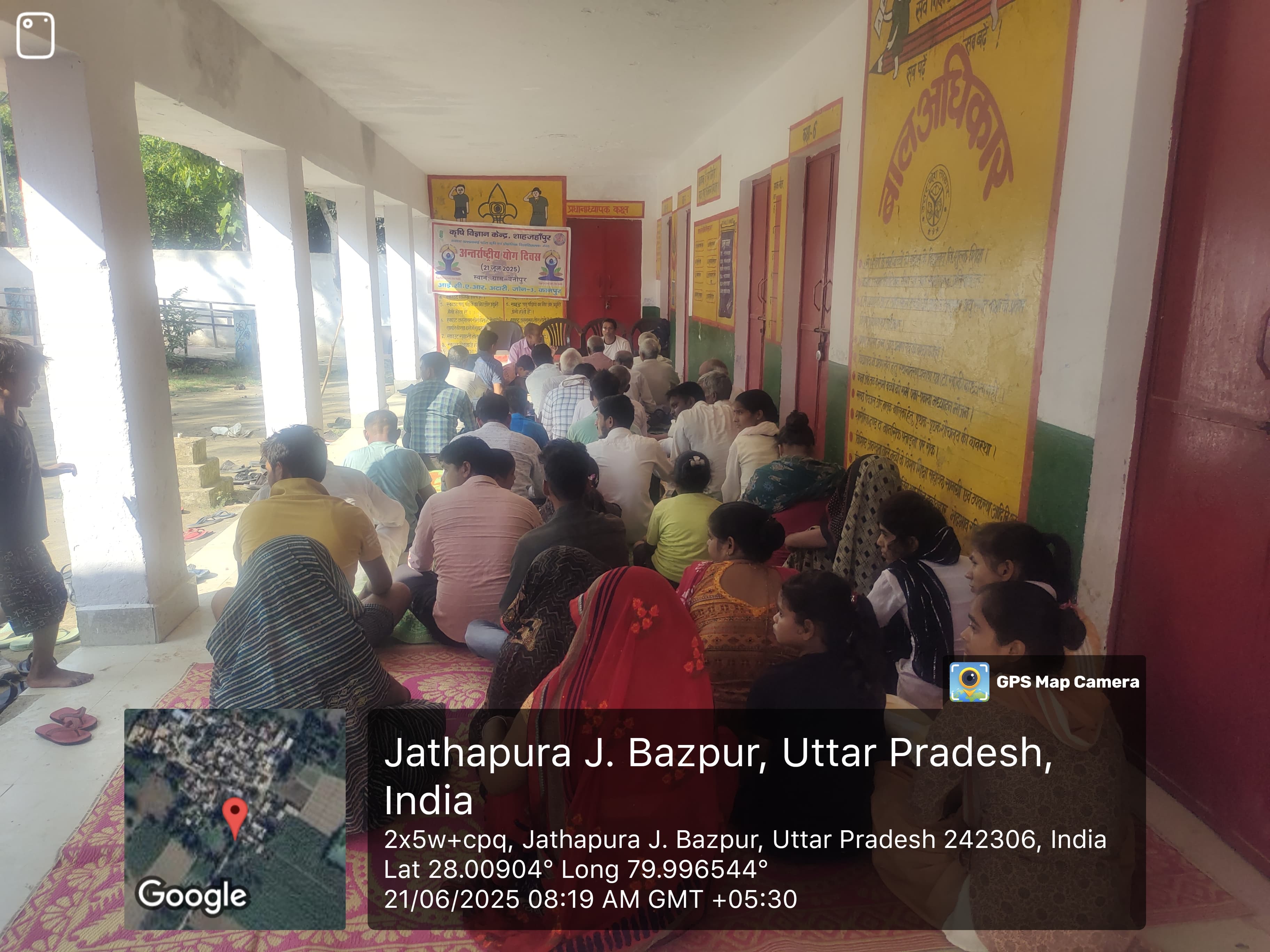
ICAR-Krishi Vigyan Kendra, Mamit
कृषि विज्ञान केंद्र, ममित
कृषि विज्ञान केंद्र, ममित
Lengpui, Reiek Block,Mamit District, Mizoram – 796410

District Profile: Mamit District, Lengpui, Mizoram
Mamit District—nick-named “The Orange Garden of Mizoram”—is the fourth-largest of Mizoram’s eleven districts. Bordered by Assam to the north, Tripura and Bangladesh to the west, Lunglei to the south and Aizawl–Kolasib to the east, it spans 3 025 km² of rugged hill terrain. Agriculture, forestry and allied livestock activities drive the local economy, while Lengpui hosts the Krishi Vigyan Kendra (KVK) that anchors technology backstopping for farmers.
1. Executive Snapshot
Mamit’s 86 364 residents are overwhelmingly rural (82.75%), predominantly Scheduled Tribe (95%) and young (18% under six). Paddy farming, jhum-based horticulture, and piggery dominate livelihoods. At 24 °C mean annual temperature and 2 794 mm rainfall, the climate supports rich biodiversity including the Dampa Tiger Reserve and high-value crops such as mandarin orange, arecanut and turmeric. Infrastructure is improving—NH-6 now links Bairabi to Mamit; eight PHCs and one District Hospital serve healthcare; 12 bank branches and 6 ATMs provide formal finance. The charts below visualize key indicators.
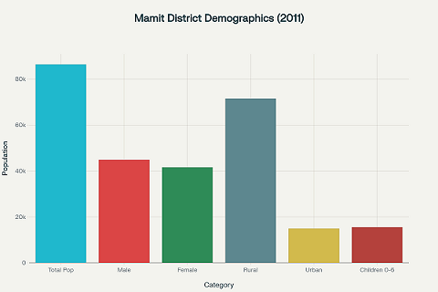
Population demographics of Mamit District showing rural-urban distribution and age-gender composition based on 2011 Census data
2. Geography & Climate
2.1 Location & Extent
2.2 Topography & Drainage
Denudo-structural hills run north–south; major rivers Tlawng, Tut, Teirei and Langkaih flow northwards, sustaining fertile alluvium pockets.[3][1]
2.3 Climate Profile
|
Parameter |
Value |
Note |
|
Mean annual temp. |
24.74 °C |
Cwa—humid subtropical[4] |
|
Winter range |
9 – 24 °C |
|
|
Summer range |
24 – 36 °C |
|
|
Annual rainfall |
2 794 mm |
|
|
Rainy days |
211 per year |
58% of days[4] |
|
Humidity |
79% average |
High |

3. Demography
|
Indicator |
2011 Census |
Share / Rank |
|
Population |
7.9% of Mizoram |
|
|
Density |
29 / km²[7] |
Lowest in state |
|
Sex ratio |
Lowest in state |
|
|
Literacy |
7ᵗʰ of 8 districts |
|
|
Urban share |
17.25%[8] |
Least urbanised |
|
ST population |
Highest share |
|
|
Child (0-6) |
15 495 (18%)[9] |
Young demography |
Language composition: Mizo (62.6%), Tripuri (17.6%), Chakma (15.2%), Bengali (1.9%).[7]

4. Economy
4.1 Agriculture & Horticulture